Description
Product details
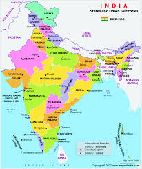
Delve into the political geography of India with our India Political Chart, a meticulously detailed visual representation of the nation's administrative divisions. Crafted with precision, this chart outlines state boundaries, union territories, and major cities, offering a comprehensive overview of India's political structure. Whether you're a student studying political science or an enthusiast eager to understand the governance of India, our Political Chart serves as an invaluable reference. Elevate your understanding of India's political landscape with this visually compelling and educational tool, where each boundary and label provides insights into the diverse governance framework that shapes this vibrant nation.